

Latest articles
Follow Us


You can usually build on land in a Special Building Overlay or a Land Subject to Inundation Overlay. Both are Victorian planning controls that mark land a major flood can reach, and neither is a blanket ban on building. What they add is a planning permit for most buildings and works, a referral to Melbourne Water or the local Catchment Management Authority, and a floor level set above the flood level by a safety margin. This guide explains each step.
ROMAAC Group designs and builds custom luxury homes, renovations and extensions in Victoria and Queensland, with services that run from pre-construction consultation and architectural design through to construction and project management. On a block with a flood overlay, the order of work matters most: flood level first, design second, permits third.
Rules in this guide were checked on 17 November 2026. Overlays and flood levels differ by property, so confirm yours with Melbourne Water or your Catchment Management Authority, the council and a registered building surveyor.
A flood overlay is a planning control on your council's planning scheme maps. It marks land that a 1 per cent Annual Exceedance Probability (AEP) flood would reach: a flood with a one per cent chance of happening in any given year, often called the 1 in 100 year flood. It does not stop you building, but most buildings and works need a planning permit, and the design must let floodwater pass and pool as it does now without a significant rise in flood levels.
Melbourne Water's guide to flood planning controls describes the original set as one zone and three overlays, and the state's practice note on the original flood provisions splits them by type of flooding. Mainstream flooding, where rivers, creeks or the coast overflow, is mapped by the Land Subject to Inundation Overlay, the Floodway Overlay and the Urban Floodway Zone. Stormwater flooding, where heavy rain overwhelms the drains and runs across the ground as overland flow, is mapped by the Special Building Overlay. The maps change as flood studies are updated, and some land that may flood is not yet shown on them. Other overlays, such as heritage or design and development overlays, work differently.
The Special Building Overlay marks urban land that floods when stormwater overflows the drainage system and runs across the ground. Under the Special Building Overlay clause, a planning permit is needed for most buildings and works, including fences, pools, decks and verandahs, unless an exemption applies.
The overlay exists mostly because of older drains. The practice note puts it plainly: "Before 1975, drainage systems were designed to a lower standard than those used today." It is mainly used in metropolitan Melbourne, though it can also apply in regional towns. An application needs a site plan with ground and floor levels to Australian Height Datum (AHD, the national reference that surveyed heights are measured from), taken by or under a licensed land surveyor. Melbourne Water says some SBO applications may qualify for VicSmart, the faster permit stream for straightforward proposals.
The SBO's standard exemptions are much wider than the LSIO's, and they decide whether a rebuild or extension needs a flood permit at all. The key one exempts works "To a replacement building (not including an out-building) if it is constructed to at least 300mm above the flood level and the original building footprint remains the same." So a knock down rebuild with a larger or reshaped footprint needs a permit, and the council may ask for evidence of the old footprint. An upper storey extension is exempt outright, which matters when weighing up a ground floor or second storey extension.
| Work | Exempt from the SBO planning permit when |
|---|---|
| Upper storey extension | Exempt, with no floor level condition |
| Replacement building, or alteration to an existing one | Same footprint, with floors at least 300 mm above the flood level |
| Extension under 20 square metres | Floors at least 300 mm above the flood level, or the floodplain management authority agrees in writing that the flow path is not obstructed |
| Fencing | At least 25 per cent openings with the plinth at least 300 mm above the flood level, or a like-for-like replacement |
| In-ground pool and safety fencing | Pool edging at natural surface level, with excavated soil removed from the flow path |
| Pergola, open deck or carport | Unenclosed foundations; a carport over an existing car space |
Two cautions. The zone, another overlay or the overlay's schedule can still require a permit. And when the overlay exempts the work, no planning permit sets the floor level, so on land the council records as a designated flood-prone area the building permit will need the council's report and consent (step 5 below).
The Land Subject to Inundation Overlay marks flood-prone land near rivers, creeks and the coast that the 1 per cent AEP flood reaches, in rural and urban areas. It generally carries a lower flood risk than the Floodway Overlay. Applications go to the floodplain management authority, the body that holds the flood information and assesses proposals against it: Melbourne Water in the Port Phillip and Westernport region, and a Catchment Management Authority elsewhere.
Under the Land Subject to Inundation Overlay clause, a permit is needed for buildings and works including fences, pools and spas, decks and verandahs, and the standard exemptions are narrow unless your area's schedule adds more. The council must also consider whether the development "could be located on flood-free land or land with a lesser flood hazard outside this overlay." Flood depth and speed on the way in and out are assessed too.
| Control | Type of flooding | What stands out |
|---|---|---|
| Special Building Overlay (SBO) | Stormwater overland flow, mainly metropolitan Melbourne | Wide standard exemptions; surveyed levels with the application; some applications can use VicSmart |
| Land Subject to Inundation Overlay (LSIO) | Rivers, creeks and the coast, rural and urban | Permit for most buildings and works, including fences and pools; few exemptions |
| Floodway Overlay (FO) | Waterways, major flood paths and high hazard areas | Flood risk report needed unless a local floodplain development plan applies; no new lots entirely within it |
| Urban Floodway Zone (UFZ) | Urban land with high potential flood risk | Controls land use as well; development generally not encouraged |
| Flood Management Overlay (FMO), new | Riverine, coastal and stormwater flooding at moderate to very high risk | Requirements set in a schedule; being introduced area by area (see below) |
A Floodway Overlay or the Urban Floodway Zone is a much harder brief than an SBO or LSIO. The state's practice note on planning permit applications under the flood provisions warns that some buildings may not be allowed, or may need to be redesigned or relocated.
Check the address, then get the flood level: an overlay shows where flooding reaches, not how high the water would rise on your block.
That last check matters because an overlay is not the whole picture. The City of Boroondara, for example, notes properties its flash flood study found at risk on property information statements under Building Regulation 153, and its guidance on building on flood-prone land warns: "Note that any property within Boroondara could be at risk of flooding now or in the future, even if it wasn't identified in our study." Boroondara also offers a free flood assessment report before plans are drawn; ask your council what it offers.
In the SBO and LSIO the answer is usually yes, if the design meets the floodplain management authority's criteria. Building in a flood zone in Victoria means a planning permit and a building permit, and the floor level must be fixed before the plans are finished.
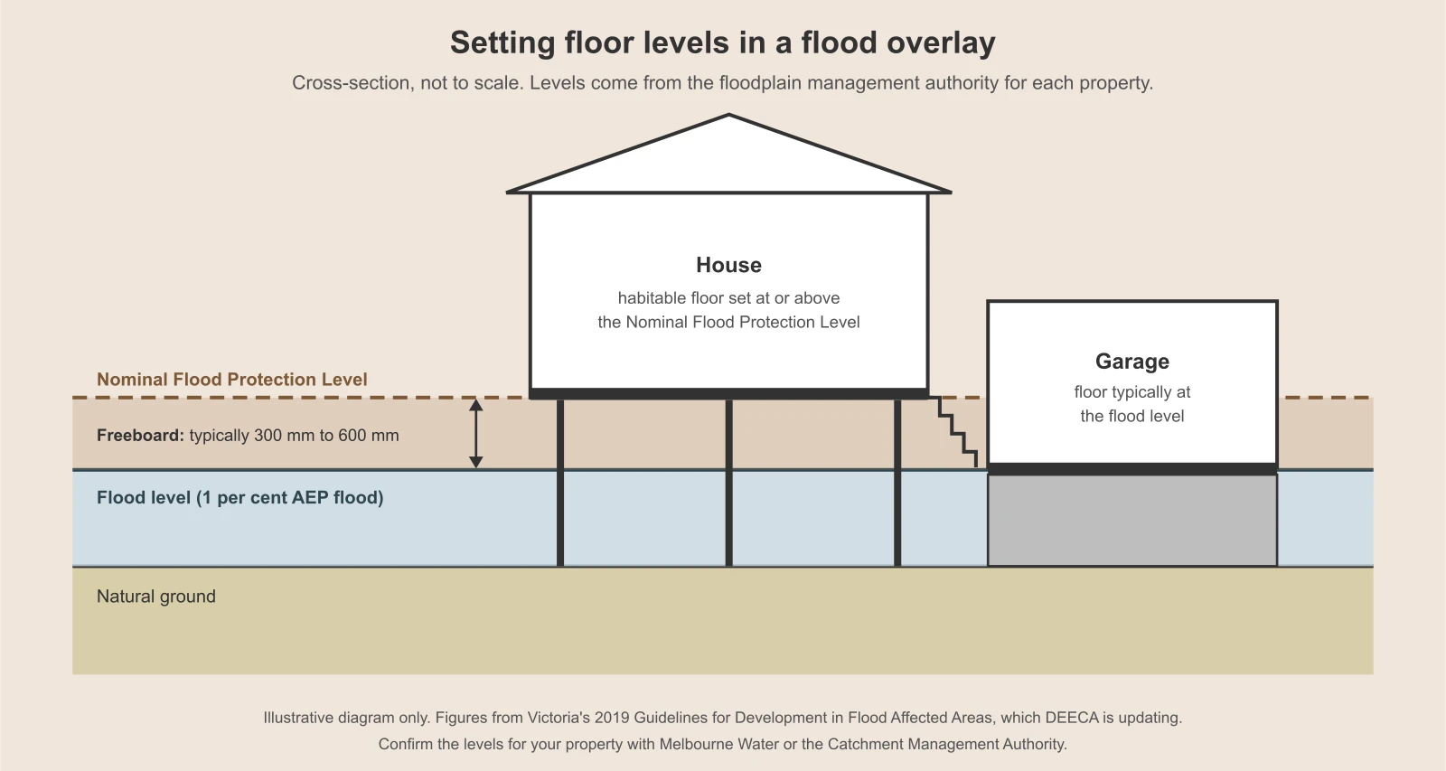
The floor of a new home is set at the flood level plus freeboard. Without a planning permit, the building regulations set a minimum of 300 mm. With one, floodplain management authorities apply a range, "typically 300 mm to 600 mm", depending on how floodwater behaves at the site. These figures come from the state's Guidelines for Development in Flood Affected Areas (February 2019), which Melbourne Water uses when it assesses proposals.
As the guidelines put it, "Raising floors higher than the flood levels is the easiest way to reduce flood damage".
| Building | Typical minimum floor level (2019 guidelines) |
|---|---|
| New or replacement dwelling | NFPL |
| Dwelling extension | Depends on its size and the existing floor level |
| Garage | 1 per cent AEP flood level |
| Shed under 20 square metres | None |
| Shed of 20 to 40 square metres | 1 per cent AEP flood level |
| Shed over 40 square metres | NFPL |
Where an existing floor is already below the flood level, some smaller extensions can match it, while larger ones generally go to the NFPL. DEECA, the state environment department, is updating this guidance, and the level that counts is the one in the authority's advice for your property, so confirm it with Melbourne Water or the Catchment Management Authority and your building surveyor before the design is fixed.
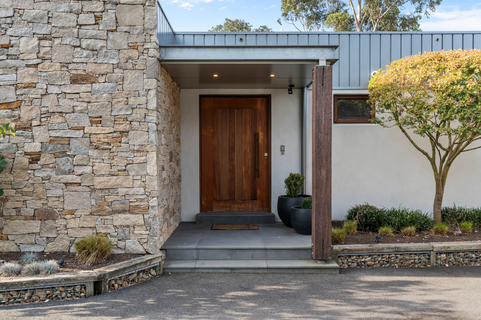
House design for flood-prone areas starts from the required floor level, because it fixes how the house meets the ground.
These choices affect each other, which is why designing the house around the required floor level works better than adjusting a finished plan.
Victoria is moving to a risk-based flood system, area by area. The SBO and LSIO remain in planning schemes and still apply where they are mapped, so check which provisions cover your property.
The sources give no single changeover date, so recheck VicPlan and the Flood Risk Rating tool before you lodge, not only when you buy.
The Special Building Overlay and LSIO are Victorian controls, so they do not apply in Queensland. There, each council maps flood-prone land in its own planning scheme. Brisbane City Plan 2014's flood overlay code sorts its Flood overlay into flood planning areas for the Brisbane River, creeks and waterways, and overland flow, and notes that the mapped area "may not reflect the full extent of the flood affected area." The City of Gold Coast's guidance on planning for flood points to the Flood overlay in its City Plan.
Building rules sit alongside the planning scheme. Under section 8 of the Building Regulation 2021, a council can designate a flood hazard area and declare its defined flood level (the expected flood height), a freeboard of more than 300 mm and the floor level for houses. Where it has, Queensland Development Code Mandatory Part 3.5 applies to building work there, so that the house resists flotation, collapse or significant permanent movement caused by flood water.
In Brisbane, the FloodWise Property Report shows a property's flood levels and the minimum habitable floor level for a house, which the council describes as the 1 per cent AEP flood level of the highest flood type plus 0.5 metres. On the Gold Coast, a flood level search report gives the designated flood level, and the council requires habitable floors at or above it plus a minimum freeboard of 300 mm. As in Victoria, settle the floor level before the design is fixed.
Insurance sits outside the planning system, and insurers use their own definitions of flood. Boroondara council recommends checking that your policy covers flash flooding from overland stormwater flow. Ask your insurer how it treats the property before you buy or build.
Not because of the flood overlay. SBO and LSIO applications are exempt from the overlay's notice requirements, but the zone or another overlay on the same land can still require notice.
Overlays change only when flood information is updated and the planning scheme is amended. If you believe the mapping is wrong, raise it with the council and the floodplain management authority.
A Special Building Overlay or LSIO adds steps to a new home, rebuild or extension and changes the order of work: flood level, then a design that meets the authority's criteria, then the permits. If you are planning a custom home or rebuild on flood-affected land, talk to ROMAAC about a block with a flood overlay before the floor plan is drawn.